Camden Buoy Data to Drive Waterfront Decisions
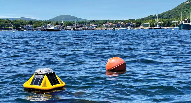 The weather buoys inside and outside of Camden Harbor measure wave height, direction, and the length of time between waves. The data is transmitted to Northeastern University and fed into a mathematical model to predict the impacts of future storms. Photo by Jeff Jordan
From a distance, the two, small yellow-and-black buoys floating just inside and outside of Camden Harbor aren’t attention-grabbers. Each one about the size of a beach ball, the hard-plastic buoys float gently on the waves.
But inside them are small computers that are continuously recording data never before collected about the wave and wind activity in and around the harbor. The information is transmitted to Northeastern University, in Boston, Massachusetts, where researchers have developed a model to predict how future storms might impact the harbor.
The buoys are part of a project, unofficially known as the Camden wave action and storm surge study, aimed at providing a model of how Camden can better protect itself from violent storms in the future. It comes at a time when ferocious storms have become more common along the Maine coast. Who can forget last January’s one-two punch that wreaked havoc along the state’s 3,500-mile coastline? Those storms—fueled by near-hurricane winds, rain and snow, record high tides, and 20-foot waves—destroyed piers, washed fish shacks and houses into the sea, flooded roadways and buildings, and battered seaside towns from Kittery to Eastport, including Camden.
They also left towns asking this: What can be done to protect ourselves from future catastrophic storms? Scientists say the recent onslaught has been brought on by climate change that has resulted in rising seas and warming ocean temperatures.
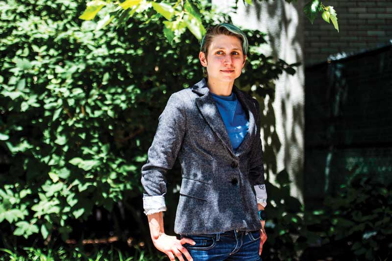 Julia Hopkins led the Camden weather buoy project as an associate professor at Northeastern University. She took a new job at MIT in the fall, but plans to remain involved in the project. Photo by Alyssa Stone/Northeastern University
In the case of Camden, researchers led by Julia Hopkins formulated a model that can predict how storms and their waves might impact the harbor. That model is based on data being collected by the two “spotter buoys” that are now in their second year of recording information. Hopkins was an associate professor of civil and environmental engineering at Northeastern, but took a job this fall at the Massachusetts Institute of Technology’s Lincoln Laboratory; she plans to continue her involvement in the project.
There are National Oceanographic and Atmospheric Administration buoys in the Gulf of Maine that collect similar data that can help predict where waves and storm surge will go on a more regional level. But the buoys in Camden will deliver hyper-local data that provides information specifically for Camden Harbor. The nearest NOAA buoy, Buoy F01, is at the mouth of western Penobscot Bay where the bay opens into the Atlantic Ocean. But that’s nearly 10 nautical miles away and measures wind and wave action there, not in Camden.
“We’re interested in seeing the transformation of these waves and storms as they come closer toward local harbors,” Hopkins said.
Camden resident Jeff Jordan said the information and the resulting mathematical model will result in what he calls a “virtual Camden Harbor.” The virtual harbor will allow town officials, including the selectmen and town manager, to evaluate any remediation efforts that might be considered. Jordan is passionate about the project, and raised $90,000 in private donations to fund it for a second year.
“Camden Harbor is Camden,” he said. “It’s not Portland or Bar Harbor or off Owls Head. It’s Camden.”
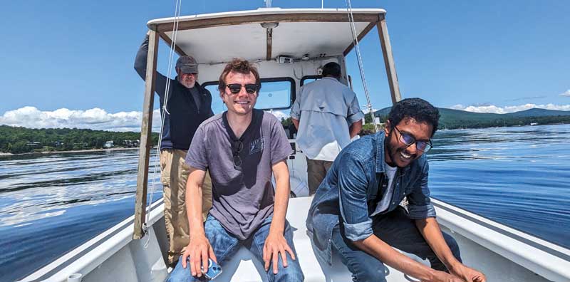 Northeastern University students Jesse Beckman, left, and Maqsood Mansur helped deploy the weather buoys in 2023 in Camden. Photo by Julia Hopkins
Hopkins and Northeastern graduate students who deployed the buoys in the fall of 2023, are interested in developing a model specifically for Camden. Hopkins has a similar project going on in Boston Harbor, but was interested in Camden because it doesn’t have the dredge channels that Boston has, or islands or other barriers to protect it.
Measuring about a foot and a half in diameter and made of hard plastic, the buoys are bright yellow with black solar panels on four sides that allow them to operate for extended periods of time. The buoys are moored to the ocean bottom and measure wave activity, such as wave height, direction, and the length of time between waves, known as the wave period. They also measure wind direction, wind speed, and barometric pressure.
The project is also collecting water level measurements from two water pressure sensors placed along the Camden waterfront.
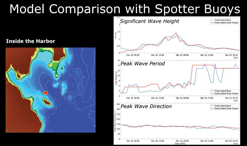 In this slide, the red dot represents the weather buoy in Camden Harbor (left). In the adjacent chart, the blue line is the data recorded by the buoy, and the red line is the prediction of the model. The closer together the lines on the graphs, the more accurate the model’s prediction. Graph courtesy of Julia Hopkins
All of that data is transmitted in real time to Northeastern, where Hopkins developed a mathematical model to predict where waves and storm surge will go to specific points within the harbor during future storms. Different variables such as the height of the tides and wind speed and direction can be changed to simulate different conditions.
The worse the conditions, the worse the potential damage to the harbor and the town.
Additionally, the model can be used to provide guidance on how the town can adapt to rising sea levels, extreme high tides, storm surges, and wave attacks. Potential preventative measures could include anything from installing a breakwater or wave attenuators—floating structures designed to reduce the energy of waves as they go toward shore—to using drainage systems to divert water to where it will result in less damage.
“Rather than be prescriptive, we want to give enough information as to what the pros and cons might be,” Hopkins said.
For now, Northeastern is collecting a second year’s worth of data to validate the first year’s findings. The $90,000 that Jordan raised will go toward paying graduate students, deploying instruments, and maintaining and visiting the buoys and the water pressure sensors.
A final report will be presented to the town this summer to provide a comprehensive understanding of the wave dynamics and storm impacts on the harbor. It will also assist in planning infrastructure improvements and developing preparedness strategies.
At a Select Board meeting last spring, officials agreed on the study’s potential benefits and the importance of using data-informed planning to enhance Camden Harbor’s resiliency to climate change.
With last January’s storms and the devastating damage still fresh in people’s minds, now is the time for Camden and other seaside towns to develop strategies to soften the impact from similar storms to come, Jordan said.
“There are lots of other harbors in Maine that are going to have to decide if they should come up with some sort of protection strategy or are we going to let things go,” he said. “Because there’s no way that it’s just going to keep happening and these will survive.”
✮
Clarke Canfield has written and edited for newspapers, magazines, and the Associated Press. He lives in South Portland.
Related Articles
Share this article:
2023 Maine Boat & Home Show

Join Us for the Maine Boat & Home Show!
Art, Artisans, Food, Fun & Boats, Boats, Boats
August 11 - 13, 2023 | On the waterfront, Rockland, Maine
Click here to pre-order your tickets.
Show is produced by Maine Boats, Homes & Harbors magazine.


